")
")
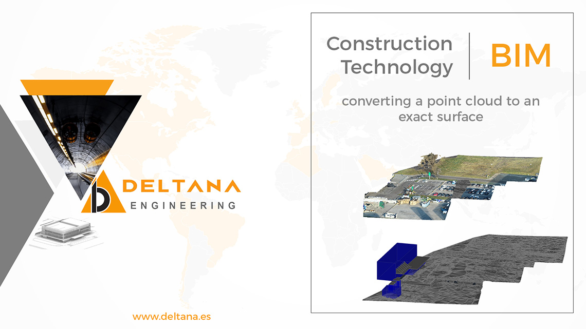
At Deltana Engineering we model terrain surfaces from point clouds using Autodesk Civil 3D, from an aerial or ground scan. This allows to have an exportable model to Revit to position a Project and that fits perfectly in the existing environment. We have collaborated in important projects in the elaboration of “As-is” models from point clouds not only of landscape but also of existing structures in the project areas. From these models we can extract measurements (Bill of Quantities) for earthworks, demolitions, etc. This is applicable to building projects and also to infrastructure works such as the layout of roads and rail projects.
Our technical team is trained for auxiliary tasks such as support to the technical office of works and projects, from design to completion of the work.
This activity complements other tasks such as the preparation of 2D plans, extraction of plans from BIM models, executive plans (Shop drawings) in structures, architecture and facilities (MEP), Steel detailing (BBS), development and updating of BIM models In Autodesk or Bentley environment, interference detection and structural calculation in auxiliary structures.